*Click image to view large.

Evening twilight on Mt. Shasta from Mt. Shasta City (May 2010)
"I consider the evening twilight on Mount Shasta one of the grandest sights I have ever witnessed."
- Theodore Roosevelt, 1908 -
Mt Shasta, CA, September
5, 2011 – Heaven on earth! Mt. Shasta was a
big goal on my bucket list for 2011. After climbing
Mt. Adams in July, I knew I was ready for the peak of
14,179’. The question was when. My friend and I set the date for the challenge....Labor
Day weekend. We decided to climb in one day without camping
overnight. We knew it would be tough, but doable, because some locals would climb it in one day.
After we assessed the pros and cons of one day summit climb, we came to our conclusion -
why not?
 Mt. Shasta is located at
the southern end of the Cascade
Range and the second highest peak in the Cascades and the fifth highest in
California. Mt. Shasta rises alone with no other competitors
nearby. It dominates the northern California landscape. On a clear day,
Mt. Shasta can be seen from 150 miles away such as Sacramento Valley, or even
farther south such as Mt.
Diablo.
Mt. Shasta is located at
the southern end of the Cascade
Range and the second highest peak in the Cascades and the fifth highest in
California. Mt. Shasta rises alone with no other competitors
nearby. It dominates the northern California landscape. On a clear day,
Mt. Shasta can be seen from 150 miles away such as Sacramento Valley, or even
farther south such as Mt.
Diablo. The poet Joaquin Miller said,
"Lonely as God, and white as a winter moon, Mount Shasta starts up sudden and solitary from the heart of the great black forests of Northern California."

Mt. Shasta "White Mountain" from Bunny Flat (May 2010)
Mt. Shasta - "the White and Pure Mountain". The origin of the name Shasta is from Russian “Tchastal” (white, clean, pure) used by the early Russian settlers in the
region. For centuries, Mt. Shasta established folklore, legend and mysticism surrounding itself and is also known as a sacred and spiritual place among Native Americans. The visitors are asked to respect
the mountain for that reason when they spend time in the mountain.


Panther Meadow with Native Americans history is a popular trail for hiking, camping and meditation.

Wildflowers in Panther Meadow and Mt. Shasta
"The Shasta region is still a fresh unspoiled wilderness, accessible and available for travelers of every kind and degree. Would it not be a fine thing to set it apart like the Yellowstone and Yosemite as a National Park for the welfare and benefit of all mankind, preserving its fountains and forests and all its glad life in primeval beauty?"

Mt. Shasta and Lake Siskiyou
 No Pain, No Gain. With no sleep, our 15 hour RT trek to the summit via Avalanche
Gulch (John Muir Route) was not only strenuous, but also grueling.
In fact, I almost threw in the towel near Misery
Hill (false summit) above 13,000’. It was a “rat race” to climb in one
day. We started the hike from the Bunny
Flat trailhead (6,800') at midnight. The hike to Horse Camp
(The Sierra Club Lodge – 8,000’) was easy and pleasant;
we even saw a scorpion on the trail!
No Pain, No Gain. With no sleep, our 15 hour RT trek to the summit via Avalanche
Gulch (John Muir Route) was not only strenuous, but also grueling.
In fact, I almost threw in the towel near Misery
Hill (false summit) above 13,000’. It was a “rat race” to climb in one
day. We started the hike from the Bunny
Flat trailhead (6,800') at midnight. The hike to Horse Camp
(The Sierra Club Lodge – 8,000’) was easy and pleasant;
we even saw a scorpion on the trail!  However, after we kept ascending from Horse Camp, we got lost near 50/50 Flat (9,400') because the trail suddenly disappeared as
the trail marker (flag) was missing part of the way and the route
became snow and ice covered. It was pitch-dark. To make
sure we “were” on the right track, we decided to descend to the last trail
marker we followed. Then, We re-ascended the route, but came back to the
same spot where we had got lost. The GPS was indicating Helen Lake
(10,400') at another 1,000’ vertical up, and the compass bearings were also
correct to that direction. Hence, we put on crampons and began climbing
straight up toward Helen Lake on the ice and snow covered Avalanche Gulch. The temperature was 28 degrees and we carefully climbed
the icy gulch about an hour and half to reach Helen Lake. The daybreak was
just
about to begin…..wow, breathtaking sunrise! Unfortunately, at Helen Lake, my friend
decided not to pursue the summit due to exhaustion. Therefore, I
decided to continue the ascent to the summit by myself, but luckily,
there were other climbers en route.
However, after we kept ascending from Horse Camp, we got lost near 50/50 Flat (9,400') because the trail suddenly disappeared as
the trail marker (flag) was missing part of the way and the route
became snow and ice covered. It was pitch-dark. To make
sure we “were” on the right track, we decided to descend to the last trail
marker we followed. Then, We re-ascended the route, but came back to the
same spot where we had got lost. The GPS was indicating Helen Lake
(10,400') at another 1,000’ vertical up, and the compass bearings were also
correct to that direction. Hence, we put on crampons and began climbing
straight up toward Helen Lake on the ice and snow covered Avalanche Gulch. The temperature was 28 degrees and we carefully climbed
the icy gulch about an hour and half to reach Helen Lake. The daybreak was
just
about to begin…..wow, breathtaking sunrise! Unfortunately, at Helen Lake, my friend
decided not to pursue the summit due to exhaustion. Therefore, I
decided to continue the ascent to the summit by myself, but luckily,
there were other climbers en route. 
Standing on the top of Mt. Shasta
14,179' was wild and ecstatic. It was totally worth the effort of "no
pain, no gain". That memory will last for a long time. You can follow my journey to the summit with the photos below.
Snow, ice and rock
fall. It is said that over 15,000 people attempt to summit Mt. Shasta
every year and only one third of them reach the summit. Avalanche Gulch
is the most popular route to the summit, and people with no mountaineering experience can climb it, being well prepared physically and mentally, and
determination along with a luck of weather. Thanks to the record-breaking snowy
winter which dumped more than enough snow in California (the CA
state finally lifted drought emergency since 1998!),
the
Avalanche Gulch route remained stable and mostly snow-covered above 9,000’ even
in early September. 2011 was one of those ideal years for
climbing Mt. Shasta because of the deep and packed snow on the route and
the
relatively cool summer, which extended the climbing season. If it was a
normal year, the snow would melt away early in the season and the route
could become more prone to rock fall hazards. Rock fall is a year round threat for climbers. When there is enough snow and ice to seal rocks along the route, it provides better climbing conditions without rock fall
danger. Although the Avalanche Gulch route is non-technical, besides ten essentials, ice axes, crampons and helmets
are necessary for climbing Mt. Shasta. One-day summit trek is
attainable, but most people climb in two days and camp overnight at
Helen Lake - 10,400’ to adjust the high altitude.
Mountain
and weather conditions: Mt. Shasta makes its own
weather. The weather can change rapidly out of the
blue. Check the
weather and andavalanche conditions before your trip.
Ominous clouds (lenticular clouds) forming
near the mountain top is usually the sign of a chance of thunderstorm and/or
lightening. Use your wise judgment to
decide when to turn around if necessary.
 This picture (left) was taken when I was snowshoeing up toward Thumb Rock - Red Banks via Green Butte Ridge (Sargent's Ridge) in May, 2010. It started out with a sunny spring day; however, snow clouds quickly forming in the early afternoon, I was forced to turn around about 9,000'. Remember there is no point to pursue a risk.
The rule of thumb is "climb early and descend early". It is advised to descend from the summit by noon or 1pm so that you have enough time to return in daylight. The other reason is timing for the snow condition for descending. To trek down the steep route between Red Banks and Helen Lake or glissade down (watch this YouTube video of glissading down 3,000' on Avalanche Gulch!), the ideal timing would be between noon and mid-afternoon when the snow gets soft, but not too slushy nor icy. Thunderstorm tends to occur in the early afternoon in late summer and fall, which is another good reason to descend from the summit by noon. Gusty wind is another weather factor to consider. Since Mt. Shasta stands by itself in the atmosphere, it creates a lot of unique wind conditions. Winds over 100 mph at tree line (8000') are common and can make it nearly impossible to stand and destroy tents. Take this seriously as wind has resulted in searches, injuries and fatalities. Contact Mt. Shasta Ranger Station for climbing and safety information and do your own study. The Fifth Season in Mt. Shasta City also provides daily updates for climbing and weather conditions as well as rental equipment for climbing and camping.
 Summit passes are
required for climbing above 10,000’. A summit pass is $20 per person and good
for 3 days. The summit pass is available at the Mt. Shasta Ranger Station, the McCloud Ranger Station, self-issue kiosks at the trailhead, and at Fifth Season or at REI stores in the Bay Area and Sacramento. A
self-issued wilderness permit is also required to enter the Mt. Shasta Wilderness if you are to climb the mountain. Permits are to be
self-issued at the trailhead and used for the rangers to keep track of the
climbers on the mountain in case of an emergency or missing.
Summit passes are
required for climbing above 10,000’. A summit pass is $20 per person and good
for 3 days. The summit pass is available at the Mt. Shasta Ranger Station, the McCloud Ranger Station, self-issue kiosks at the trailhead, and at Fifth Season or at REI stores in the Bay Area and Sacramento. A
self-issued wilderness permit is also required to enter the Mt. Shasta Wilderness if you are to climb the mountain. Permits are to be
self-issued at the trailhead and used for the rangers to keep track of the
climbers on the mountain in case of an emergency or missing.
Camping: Helen Lake and the Sierra Club Horse Camp are two popular camping
areas en route to the summit via Avalanche Gulch. Leave No Trace! - human waste
removal bags must be
carried by all climbers on the mountain and available for free at all trailheads.
Elevation Gain: 7,282'
RT Distance: 11
miles
Summit Elevation: 14,179’
How to get there:
Summit Elevation: 14,179’
How to get there:
Bunny
Flat is the trailhead for the Avalanche Gulch route to the summit. Take
Everitt Memorial Highway from Mt. Shasta City and drive up to the Bunny Flat
trailhead (6,900’). There is a huge parking lot where you can park.
The trailhead is located to the right of the restroom. From Bunny Flat,
hike two miles to Horse Camp (8,000’). The summit trail begins behind the
Sierra Club Lodge. There is no trail sign after Horse Camp.

 Useful contacts and resources:
Mt. Shasta Ranger Station (Forest Service)
Mt. Shasta Ranger Station (Avalanche Report)
McCloud Ranger Station (Forest Service)
The Fifth Season's (24 hour climbing & skiing report)
Ample parking is available at Bunny Flat Trailhead.
 Useful contacts and resources:
 Mt. Shasta Ranger Station (Forest Service)
Mt. Shasta Ranger Station (Avalanche Report)
McCloud Ranger Station (Forest Service)
Weather Forecast (NOAA) for Mt. Shasta
Mt. Shasta Terrain and Photo Map
Mt. Shasta Collection of Maps and Graphics
 |
| Mt. Shasta Climbing Routes - South West Side |
Avalanche Gulch Route
(Red Line)


Ascending the steep Avalanche Gulch. (above) The route was crusty snow. Casaval Ridge runs along the west side of the gulch. Side view of The Heart and Casaval Ridge around 12,200'. (Right)
"At last the water went down... Then the animal people came down from the top of Mount Shasta and made new homes for themselves. They scattered everywhere and became the ancestors of all the animal peoples of the earth."
- Shasta Indian Flood Legend -
The Journey


Trailhead at Bunny Flat (6,800'). We started our journey at midnight (no sleep!), aiming to reach the summit before noon. The first destination was Horse Camp (8,000'). The Sierra Club Alpine Lodge is a historical landmark. The Lodge was dedicated on July 4, 1923 and built
primarily of indigenous materials including volcanic rock and
Shasta red fir.

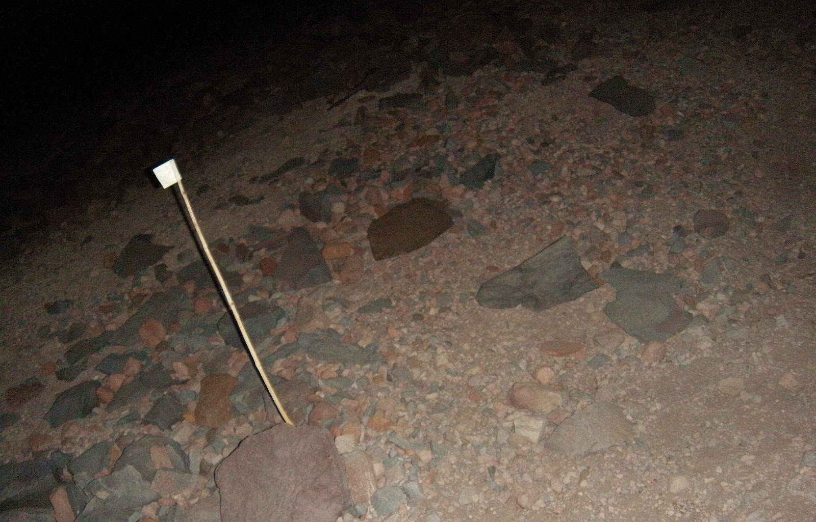
Summit Trail is located behind the Lodge, and well maintained, but rocky. After this point, there is no trail sign, except posted "flag markers" guiding the climbing route. However, some were missing and it was pitch-dark; hence we got lost!

View SW of Helen Lake (10,400') at dawn. Snowfield and campers tents at the base camp as foreground, Mt. Shasta City, Lake Siskiyou and the Trinity Alps are in frame. Mt. Eddy (9,025') and Castle Grags are visible in the range.


Ascending the steep Avalanche Gulch. (above) The route was crusty snow. Casaval Ridge runs along the west side of the gulch. Side view of The Heart and Casaval Ridge around 12,200'. (Right)

The Heart (12,200') (heart-shaped rocky area) carves out the slope below Red Banks (12,400'). The climbing route is to pass the right side of the Heart and go up to Red Banks. During the early climbing season when the snow is deep and plenty, the route is typically to climb via Thumb Rock (12,923') from the Heart. Later in the season when the snow melts away at Thumb Rock and rock fall becomes more prone, climbers ascend via Red Banks instead.


Climbing farther up is to reach Red Banks near 12,400'. Timing was right - the sun started to hit Red Banks so that the snow en route would soften up a little to ease the ascent of the most difficult part of the Avalanche Gulch Route - the steep chute at Red Banks.

Climbing straight up the steep and narrow chute between "chimneys" at Red Banks was like "scrambling on ice and snow". It was my very first time ever that I truly appreciated that I had the ice axe and crampons.


Red Banks and the Chimneys

Misery Hill (13,800') in sight after Red Banks. (Left) No snow!? It was dry and rocky. You'd wish the peak you see is the summit, but it is not; thus, it's called Misery Hill, which makes you feel "miserable". You've come this far. Stay focused and make one step at a time and keep climbing. Also, note that Misery Hill is where climbers sometimes face to give up the summit due to gusty winds over 100 mph; hence, "Misery Hill".

View south from the lower plateau of Misery Hill. Shastarama Pt. (11,135'), Thumb Rock (12,923'), Sargent's Ridge and Green Butte are seen down below. McCloud, Mt. Shasta City and I-5 are visible in the valley as the Trinity Alps looms over. In the distance Mt. Lassen (10,462') and its volcanic range dominate on horizon.

View south from the half way point around 13,500' to the top of Misery Hill.
View south from the lower plateau of Misery Hill. Shastarama Pt. (11,135'), Thumb Rock (12,923'), Sargent's Ridge and Green Butte are seen down below. McCloud, Mt. Shasta City and I-5 are visible in the valley as the Trinity Alps looms over. In the distance Mt. Lassen (10,462') and its volcanic range dominate on horizon.


View from the top of Misery Hill at 13,800'.

View west from Misery Hill. Mt. Shastina (12,330') in the middle and Whitney Glacier in between. Weed and Lake Shastina in the valley.

The summit pinnacle comes into sight as you trek across the snow field after Misery Hill.


A few more hundred feet to climb. The final push to the summit with all your might. The summit is right up there!


The summit at 14,179'!
Summit Register

View east of the summit and Wintun Glacier.

View West of the summit. Whitney Glacier down below, and Lake Siskiyou, Weed, Black Butte, Mt. Eddy and the Trinity Alps are seen in the valley.

View northwest of the summit. Whitney Glacier and Cascade Gulch down below. Weed and Lake Shastina in the valley.

View north from the summit. Mt. McLaughlin (9,495'), OR is visible vaguely on horizon (far right). Climbers sending a real time text/pic from the peak at 14,179'.

Panoramic view south and west of the summit.

A few hundred feet below the summit and off the trail, I noticed the Sulphur Springs, which John Muir wrote about in his epic 1875 summit survival story “Snow Storm on Mount Shasta.”
 |
| Steam coming out of the hot spring. |
Epilogue
A few weeks before my climbing trip to Mt. Shasta, a friend of mine told me about the memorial bench at Bunny Flat which I had never heard of - the story of the two young boys who died in a car accident on their way home after they successfully scaled Mt. Shasta 14,179'. My friend said the boys were her friends' sons. Connecting the dots..... When I went back to Bunny Flat the day after my journey to the summit, I happened to notice a bench in the meadow by chance. When I saw it, I knew it right away.....it must be "the bench". I decided to include this story of "serendipity" in this post. May Kevin and Travis rest in peace in heaven where they can see Mt. Shasta now and forever.
 |
| The memorial bench at Bunny Flat. |
The plaque on the bench.

Picturesque Mt. Shasta

Mt. Shasta and Black Butte from the Trinity Alps. (Castle Lake Rd.)

Mt. Shasta and Shastina from Mt. Shasta City. The Heart and Red Banks are seen on Avalanche Gulch, and Thumb Rock and Sargent's Ridge continues.

The southwest face of Mt. Shasta from Ski Park HWY - the summit pinnacle is visible on top. Shastina, Casaval Ridge, Avalanche Gulch, Green Butte, Old Ski Bowl, Shastarama Pt. and Thumb Rock along Sargent's Ridge, Konwakiton Glacier and Clear Creek are visible. (Left to Right)

Mt. Shasta from McCloud. (south view)

Shastina in front and Mt. Shasta from Weed.

View from north - HWY 97 near Haystack/Yellow Butte. Shastina, Whitney Glacier, Bolam Glacier, Hotlum Wall, the Step and Hotlum Glacier are visible.


View from east near The Whaleback on Forest Route 42N12. Mt. Shasta looks like Mt. Fuji in Japan!
 View from Old Ski Bowl Trail (7,800'). Green Butte partially framed to the left, Casaval Ridge, Avalanche Gulch, Broadway, Green Butte, Thumb Rock, Shastarama Pt. and Sargent's Ridge are in frame. (left to right)
Mt. Shasta and Shastina. Northwest view from HWY 97.

Mt. Shasta and Black Butte from I-5 north of Weed.