Showing posts with label Tioga Pass. Show all posts

Friday, October 13, 2017

Clouds Rest 9/28/2017 - Yosemite NP, CA


9-28-2017

Clouds Rest offers one of the most breathtaking 360 panoramic views in Yosemite Valley as it gives the best vantage point of the valley.  The hike also provides quite an impressive and thrilling experience as you traverse the narrow ridge with sheer drop-offs on both sides to reach the summit. The fastest and shortest way to scale Cloud's Rest is from the Sunrise Lakes trailhead on Tioga Road near Tenaya Lake. 

From the trailhead, follow the trail sign for Sunrise H.S.C. After the first 1.5 mile, the trail starts to climb steeply in switchbacks. The switchbacks will get your heart rate going no doubt as you gain 1,000' in just one mile. No pain, no gain! Go easy and be careful as you cross the narrow ridge to the top...both sides of the sharp ridge are sheer drop-offs.

Take in amazing vistas from the summit...many of Yosemite landmarks such as Half Dome, Mt. Hoffman, Mt. Dana, Sentinel Dome, North Dome, Tenaya Lake, Cathedral Rock and El Capitan...and many peaks of High Sierras.

There were rockfalls at El Capitan two days in a row. The second rockfall at El Cap was seen in this hike from the top of Clouds Rest.


Video by Lifeisamt


El Capitan's Second Rockfall Seen From Clouds Rest 9/28/2017 - Yosemite NP, CA

3:22 PM, 9/28/2017


9-28-2017

El Capitan's massive rockfall occurred for second straight day, Thursday, Sept. 28, 2017, in Yosemite National Park. A gigantic granite slab fell from the east wall of El Capitan. I was hiking up Clouds Rest on Thursday and happened to see the rockfall covering the valley with a cloud of dust.  

It's a sobering reminder that the landscape is constantly changing even though it may not seem like that.


Video by Lifeisamt


3:19 PM
3:20 PM
3:22 PM
3:25 PM
3:25 PM
3:25 PM
3:28 PM
3:29 PM
3:34 PM
3:34 PM
3:34 PM
3:35 PM
3:37 PM
3:44 PM


Friday, September 1, 2017

Hike up Mount Dana (13,061') 8/15/2017 - Yosemite National Park, CA


August 15, 2007

Mount Dana 13,061' is the second highest peak in Yosemite after Mount Lyell (13,120'). The trail reaches the summit in 2.6 miles. It's relatively a short hike; however, the journey to scale Dana is challenging due to high altitude climbing up to over 13,000'. So, pace yourself as you go.  

There's no trailhead sign for this hike. The trail starts right behind the staff parking area ("Authorized Vehicles Only") across the road from Tioga Pass East Entrance of Yosemite NP. The trail is in good shape over all. The first mile is loaded with wildflowers, wow! Their display is quite impressive. 

The trail climbs steeply after meadows with lakes and flowers. Soon the forest thins out and steep rocky terrain begins. Enjoy views as you go. There's a short snowfield to cross around 11,600', but not difficult to traverse. The last 700' to the summit gets tough with the trail climbing up the steep slope of scree and talus rock above 1,2000'. Follow cairns as you go.  

Although the journey started out with blue skies and broken clouds, by the time when I reached the top, clouds rolled in covering the west side of the mountain while the east side remained clear. Hence, there was no view to the west, but the view to the east was spectacular with Mono Lake, Dana plateau/glaciers and beyond. Although the western views were blocked with the clouds, it actually created such a surreal beauty surrounding the summit. It was worth the effort. 

Big mountains like Dana make their own weather. Keep an eye on cloud formations for whiteout and thunderstorms. Mountain weather can change very quickly. Stay vigilant as you go. Happy hiking! ;)


 Video by Lifeisamt

Tuesday, February 7, 2017

Tioga Pass, Tuolumne Meadows and Lower Cathedral Lake - Yosemite National Park, CA


"This I may say is the first time I have been to church in California." 
 (John Muir after making the first recorded ascent of Cathedral Peak in 1896.)


October 22, 2016


Distance:  7 miles round trip to Lower Cathedral Lake 
Trailhead Elevation:  8,500 ft  
Lower Cathedral Lake Elevation:  9,290 ft
How to Get there: Traihead is located at 1/2 mile west of the Tuolumne Meadows Visitor Center. Park your car along the road and make sure not to block traffic. Shuttle Stop #7.  Start hike at Cathedral Lakes trailhead, 

Late October, gorgeous fall colors are seen along Tioga Pass Road as you drive from HWY 395 to Yosemite National Park's high country. Snow capped eastern High Sierra's craggy peaks are so dramatic and breathtaking.  

The hike starts near Tuolumne Meadows along Tioga Road. The trail to Cathedral Lake is part of the John Muir Trail.  This is a very popular hike, so there will be other hikers on the trail.  But, no worries....crowds are much less compared to Yosemite Valley's zoo like condition! 

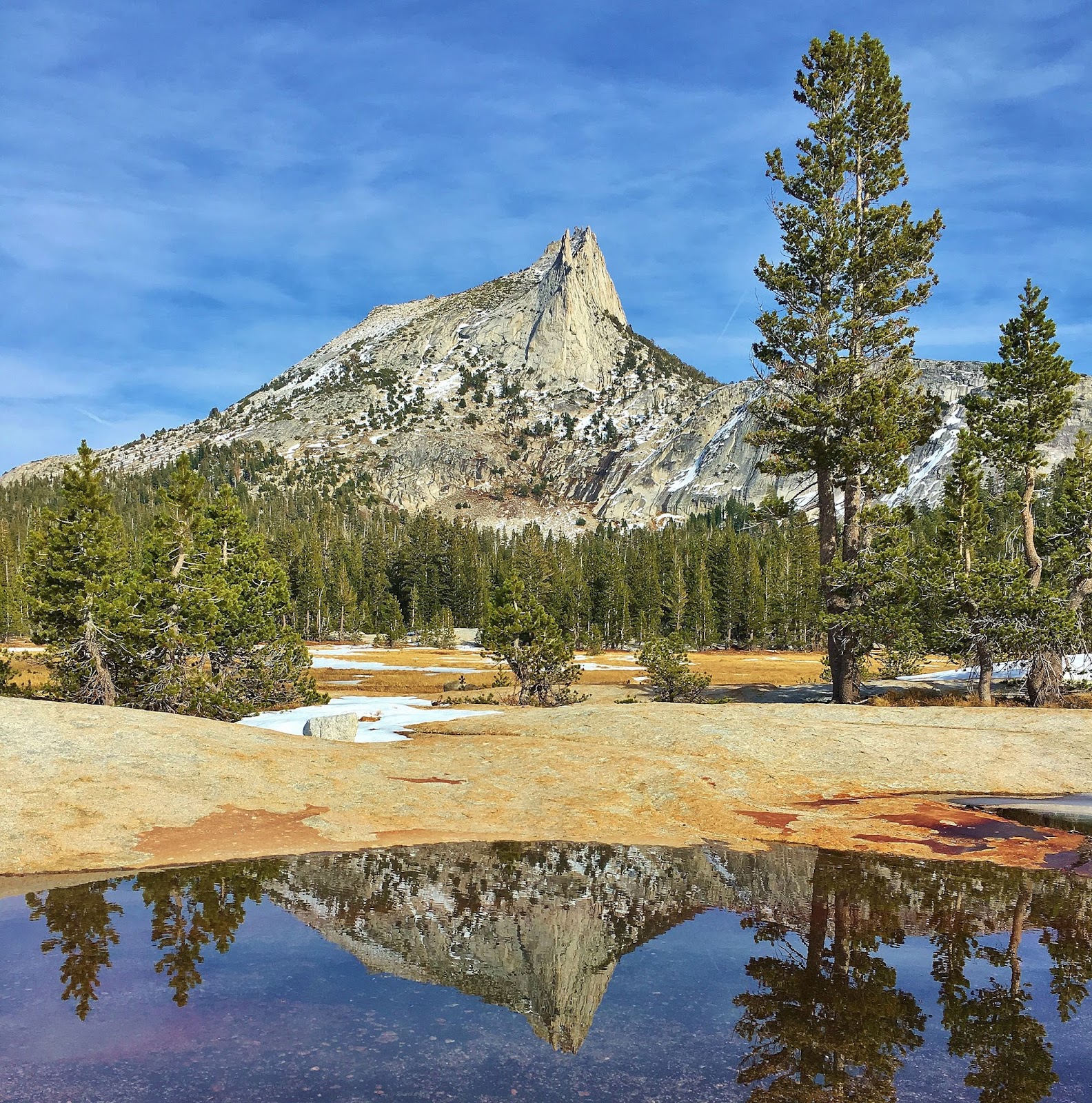
Lower Cathedral Lake offers quite impressive landscape of Yosemite's granite slabs/boulders and High Sierra's peaks with alpine lakes. Cathedral Peak, Echo and Tresidder Peaks loom along Lower Cathedral Lake. Enjoy spectacular landscape and views of high peaks and the alpine lake. It's like you are in a paradise. You can explore trekking along the meadows and the lake. There are plenty of perfect spots for your lunch or napping on the granite slab around the lake.

The hike climbs steadily from the beginning, but it's mostly gradual grade with some steep sections. Overall, it's easy to moderate hike, except high altitude/8,500 - 9,290 ft. You can also hike up to Upper Cathedral Lake adding extra 1/2 mile with 300 ft gain if you wish.