Sunday, April 4, 2021

2,000 Year Old Cherry Blossom Tree Yamataka Jindaizakura 樹齢2,000年山高神代桜


2,000 year old cherry blossom tree - Jindaizakura. It's the oldest cherry blossom tree in Japan! Truly amazing!! It's a must see. 🌸🌸🌸

3 Great Cherry Blossom Trees of Japan There are three Great Cherry Blossom Trees in Japan. They are Miharu Takizakura (1,000 years old) in Fukushima, Usuzumizakura (1,500 years old) in Gifu and Jindaizakura (2,000 years old) in Yamanashi. The three great sakura trees have lived for many centuries and still counting. They are beautiful, magnificent and legendary. Jindaizakura One of the three great cherry blooms trees is Yamataka Jindaizakura located in Jissoji Temple. It's the oldest among the three and estimated 2,000 years old. The history of Jindaizakura goes all the way back to legendary Yamato Takeru known as Prince Otsu who served as Japan’s 12th Emperor. It is said that it was Yamato Takeru who planted the tree while traveling in the region during the first century. Uchūzakura In Jissoji Temple there is another interesting sakura called Uchūzakura, namely, Space Cherry Blossom Tree. In November 2008, NASA's space shuttle Endeavor took 118 seeds of Jindaizakura harvested by local school children to the International Space Station (ISS). The seeds returned to Earth after orbiting the planet for 8 months. Among those seeds planted, two of them germinated and one of the two was planted in the garden of Jissoji Temple, that is, Uchūzakura/Space Cherry Blossoms. Interestingly, some of Space Cherry Blossoms have 6 petals instead of 5. Furthermore, Buddhism has it that there are 6 realms into karmic rebirth...hell, hungry gods, animals, angry gods, humanity and heavenly gods. Perhaps, the 6th petal appearing in some of Space Cherry Blossoms represents the realm of heaven as in Buddhism since the seed orbited Earth in the heavenly sky. Jindaizakura Info: https://www.yamanashi-kankou.jp/foreign/english/topics/jindaizakurar1eng.html Jissoji Temple: https://www.jindaizakura.com My visit to 1,000 year old Miharu Takizakura in Fukushima: https://youtu.be/7YT-LRxBxjc


2,000 year old cherry blossom tree - Jindaizaukra
Spring of 2021

Video by Lifeisamt


Sunday, March 21, 2021

Slideshow - Beautiful Mountains and Landscapes


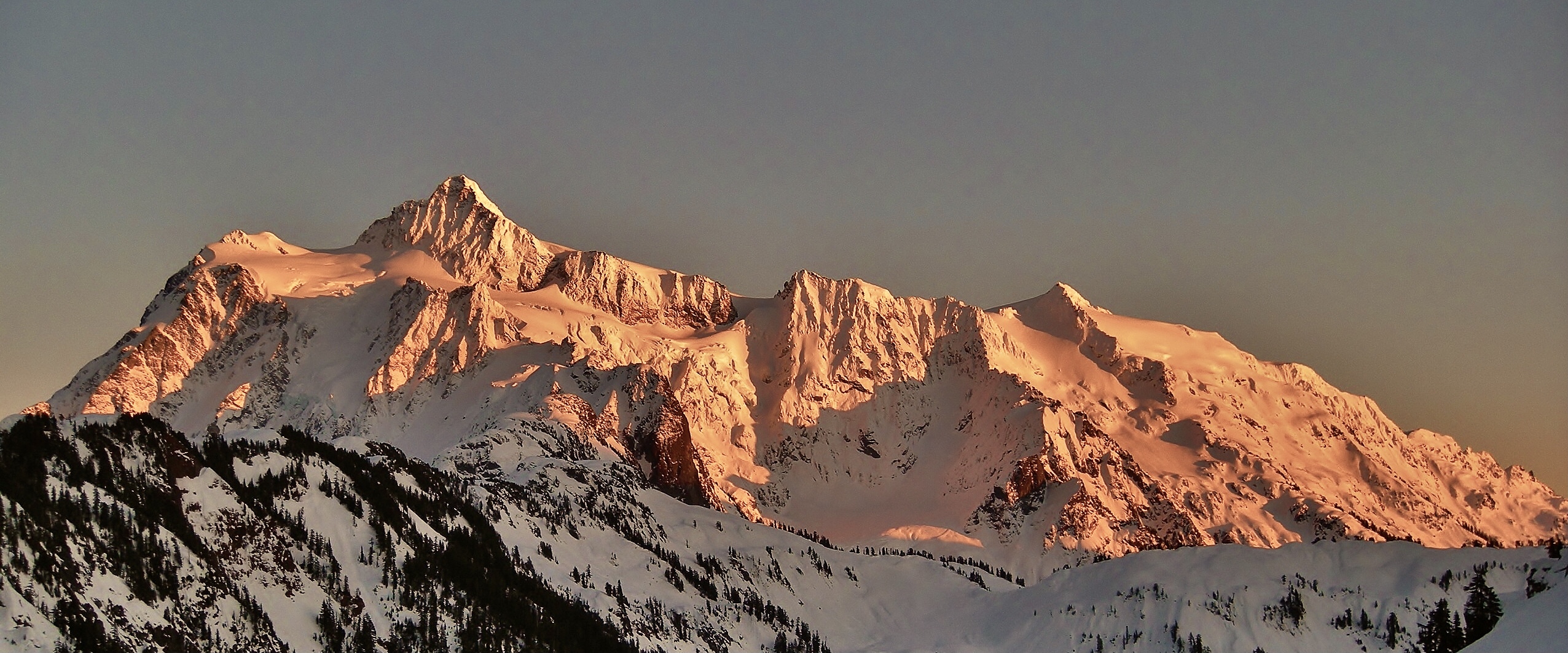
This is a slideshow presenting beautiful mountains and landscapes from some of the hikes I went on in California and Washington states.

California:
Yosemite, High Sierra, Mt. Whitney, Death Valley, Lake Tahoe, Ralston Peak, Maggies Peak, Joshua Tree, Anza Borrego, Point Reyes, Mt. Tam, McWay Falls, Point Mugu, Big Pine Lakes, Sam Mack Meadow, North Palisades, Kearsarge Pass, Sequoia/Kings Canyon, Half Dome, Firefall, El Capitan, Clouds Rest, Mt. Hoffmann, Mt. Dana, Cathedral Peak, Mt. Shasta, Desolation Wilderness, Alamere falls, North Table Mountain, Phantom Falls, Round Top Mountain, Red Lake Peak, Winnemucca Lake. Mt. McCoy, Walker Canyon, Carrizo Plain, Tamales Point
 
Washington:
Mt. Baker, Mt. Rainier, Mt. St. Helens, North Cascades, Colchuck Lake, The Enchantments,  Mt. Adams, Maple Pass, Mt. Ellinor, Mt. Washington, Sourdough Mountain, Hidden Lake, Skagit Valley, Table Mountain, Cascade Pass, Sahale Arm, Palouse Falls,

Camera used: 
iPhone 6s 
iPhone 8 
Nikon Cool Pix


Video by Lifeisamt

Mt. Adatara Fall Foliage Hike - 安達太良山 紅葉ハイク


October 20, 2020 

Spectacular display of fall foliage is on parade in Mt. Adatara, Fukushima, Japan. Gorgeous fall colors are breathtaking and can be seen endlessly all along the trail and through the mountains as you go. This is one of the most beautiful fall hikes I’ve gone for.🍁🍁🍁 Totally jaw dropping and eye popping! 😲🤩 The massive volcanic crater near the top is quite a sight and otherworldly.🌋 

The hike offers spectacular vistas, colors and landscape. In addition, soaking in the hot springs right by trailhead wraps up the hike perfect!♨️👍

Trail is well maintained and hiking boots are recommended as the route gets partially rocky and muddy. 

Hiked on 10/20/2020 
Summit: 1,700m(5,577ft) 
Gain: 750m(2,460ft) 
Distance: *10km(6.2 miles) loop including 2km/ropeway to descend 

*I took 6km(3.7 miles) route to summit Mt. Adatara ascending from Okudake trailhead via Kurogane Hut. However, most people take 4km route to Mt. Adatara using ropeway from trailhead to Yakushidake and trek to summit. 

Info about Mt. Adatara: https://www.city.nihonmatsu.lg.jp/page/page002703.html


Video by Lifeisamt


Hiking Chausu-dake (Nasu-dake) - 茶臼岳(那須岳)


August 20, 2020

I went on a half day/sunset hike scaling Mt. Chausu (Chausu-dake/1,915m) which is an active volcano. It’s one of the five volcanic mountains forming Nasu Five Peaks (Nasu-go-take). Nasu-dake is located in the north of Nikkō National Park, Japan. It’s also listed as one of the best 100 mountains in Japan.

What a great hike! This is a good workout hike with spectacular views, dramatic landscapes, volcanic steam rising, and mystical energy surrounding. It’s really cool. Two thumps up!!👍👍 

The trail is in good shape, well marked and relatively short (100 minutes to summit according to trail map). It gets rocky as you ascend, so hiking boots are recommended. Stay hydrated along the way if you hike Nasu-dake in summer as the trail is mostly exposed to the sun with no shade. ☀️😅 Happy hiking! 👍😎 

Hike Date:          8/20/2020 
Distance:           10-12km RT(?) 
Elevation Gain:   500m (approx.) 
Summit:            1,915m

Japan National Park: Nasu-dake


Video by Lifeisamt


Tuesday, November 19, 2019

Climbing Mt. Fuji (3,776m/12,390ft) - 9/16/2019


Mt. Fuji summit crator

The Journey

Climbing Mt. Fuji was one of my bucket lists this year, so I'm glad I could cross that out. I scaled Mt. Fuji via Fujinomiya Route on 9/16/2019. The official climbing season/2019 ended on September 10, and mountain huts/toilets en route were already closed and not available until 2020 season. Hence, I climbed at my own risk. Be well prepared for frequent weather/temp change (rain, mist, gust, rockfall, whiteout, clouds and intense sun) and altitude sickness during the climb as Mt. Fuji is a solitary mountain and the surrounding weather changes so quickly as it develops its own weather. 

Mt. Fuji is named UNESCO’s World Heritage Cultural site since 2013. Climb and experience Mt. Fuji in environmentally/ecologically conscious manner for generations to come. 

Distance/Fujinomiya Trail: 10km RT 
Elevation Gain: 1,376m (2,400/3,776) 
Summit: 3,776m (Kengamine Peak)

About Mt. Fuji  

Mt. Fuji (Fujisan) is the most iconic peak of Japan. It is Japan's highest (3,776m/12,390ft) and most famous mountain, inspiring Japanese art and literature for centuries. It is also revered as a sacred mountain and many climbers attempt to summit and see the sunrise. Mt. Fuji is an active stratovolcano and last erupted in 1707-1708.

The official climbing season is from early July to mid September. This is when the mountain is usually free of snow and the weather is relatively mild.

There are 4 officially designated trails for climbing Mt. Fuji, and each trail is divided into 10 stations with 5th station as trailhead. The 4 trails are Yoshida, Fujinomiya, Subashiri, and Gotemba trails. Depending on the trail, the terrain and condition of the climbing route vary with distance, incline, rockiness/sandiness, facing north/east/south.  

Yoshida Trail

Elevation: 2300m
Ascent: 6 hours
Descent: 3.5 hours
This is the most popular climbing route and the most accessible with many mountain huts along the way.

Fujinomiya Trail

Elevation: 2400m
Ascent: 5 hours
Descent: 2 hours and 45 minutes
This is the southern approach to summit. It is the shortest and steepest route. 

Subashiri Trail

Elevation: 2000m
Ascent: 5.5 hours
Descent: 3 hours
Subashiri Trail starts in the forest and meets Yoshida Trail near the 8th station.

Gotemba Trail

Elevation: 1400m
Ascent: 7.5 hours
Descent: 3 hours
This is the longest approach to summit per time and distance and the terrain is sandy.

For detailed infomation and guidelines of climbing Mt. Fuji, visit the official web site for Mt. Fuji Climbing.


Video by Lifeisamt

At Mt. Fuji summit: 3,776m (Kengamine Peak)