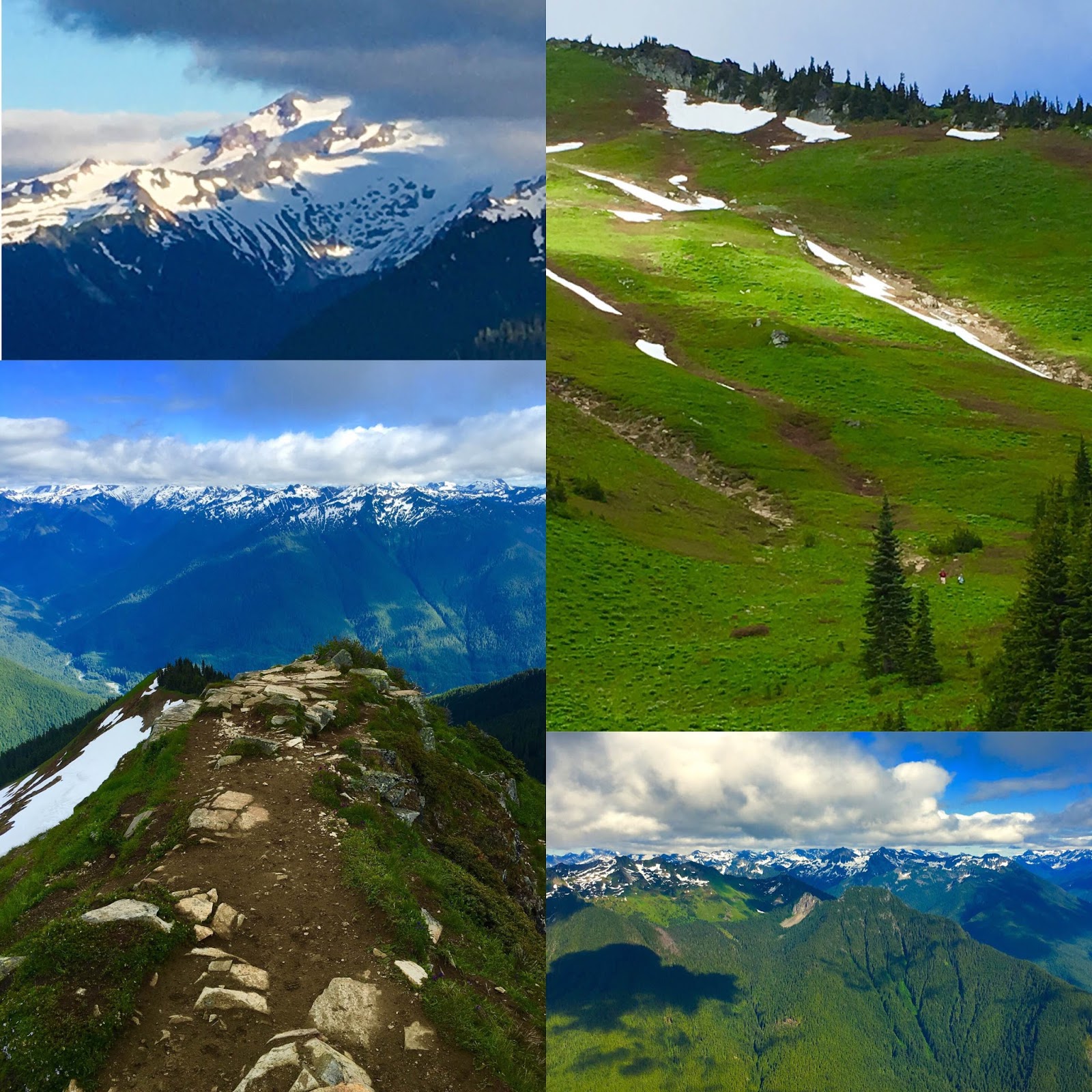
Hiking and climbing mountains inspired me into this life philosophy - LIFE IS A MOUNTAIN. Every step you make leads to summit. You may be forced to turn around or change routes for any cause, never know. But, stay focused and look forward. The mountain will be there always. Pace yourself and reach "your" summit, for every step counts. Enjoy the view and feed your soul as it comes along. Life is a journey, not a destination. Life is like climbing a mountain.....
Spring snowshoeing at Mt. Baker! The
road is snow/ice free to the parking lot at the end of the road, The road to
Heather Meadow and Artist Point is still closed. The snow is still deep and
plenty in the mountain. It'll be a while to melt away. I hiked up to Artist
Point and also took a side trip to Huntoon Point. The views were spectacular
with some clouds forming over the mountains.....Mt. Shaksun, Mt. Baker, Table
Mountain, Glacier Peak, Baker Lake and US/Canadian border peaks. I almost had
the entire mountain just for myself until I saw a couple of campers and skiers.
This is one of my favorite hikes whenever I do for all seasons, snow white
mountains and landscape in winter/spring or carpets of wildflowers and meadows
in summer/fall.
No pain, no gain! This is a tough hike gaining 5,100 vertical feet in
5.2 miles, but the reward of reaching the summit and the lookout is
tremendous with jaw dropping vistas of N. Cascades
peaks/glaciers/valleys, Ross Lake and Diablo Lake. And, a sense of big
accomplishment echoes within no doubt. If you want a physical (and also
mental) challenge to earn amazing landscape and mountain views for your
hike, this is a good one to try.
Trailhead
There is a big
trail sign on Diablo St. Park your car along the street. There is a
storage(?) building right there. You'll see a trail information board on
the left of the building, but the actual trail is located behind the
building on the right side.
Sourdough Mountain
The trail
climbs steeply in the first 3.5 miles. You'll notice trail's steep
grade from the beginning as the first 2 miles gain 3,000 vertical feet,
which reminded me of the steep trails of Mailbox Old Trail and Mt. Rose.
The journey goes through the dense forest and lush vegetation about 3
miles (making you feel it's endless!) until the treeline gradually thins
out. To some point, I felt like meditating (mental challenge!), except
I had to keep trekking instead of being still. In about 3.5 miles,
views finally start to open. As you continue to gain elevations, the
view gets better and better....wow! There is a creek to cross at
Sourdough Camp, but it's almost completely dry and just a little streak
of water running. So, bring enough water with you for this strenuous
hike.
The last mile or so climbs the steep face of the
mountain's hillside with switchbacks and gets a little rocky here and
there. Wildflowers (paintbrush) are still blooming and fall colors are
starting to show, too. And, there are so many wild berries there! Ripe
and sweet!! I think I picked at least a half pint or so munching them
along the way to the top. Yum!! Rejuvenated with berries sweet power,
the final push to the summit felt a bit easier.
Lookout
To
reach the lookout on the summit, continue to the right (east) following
the trail, and soon you'll see the lookout standing on the hilltop not
so far. The trail moderately gains elevation to the lookout in a short
distance about 1/3 mile.
Take in the fantastic views! Wow!
Before you is the reward after the grueling march ascending 5,100 feet!
Spectacular vistas of high peaks and valleys of N. Cascades in all
directions as far as you can see and Ross Lake and Diablo Lake down
below. The colors of the lakes are amazing - deep blue and emerald
green...another Wow moment. The summit is fairly spacious and covered
with granite slabs/rocks so you can explore the area around the lookout
(keep "minimum impact" in mind) and enjoy different perspectives of the
views and terrains. You'll come to know why this mountain top was chosen
for the "lookout" point.
The lookout is locked/closed to the
public and it's the National Historic Lookout Register. It was one of
the first lookout points established by the USFS in1915. Through the
window you can observe what's inside. Items displayed inside look
interesting....it's like a museum.
I guess this hike may be
intimidating, probably because of the elevation gain for the distance
with the steep trail, but it's doable if you are a fit or seasoned
hiker. Just take your time and pace yourself. The reward you see from
the top is beyond description. It took me 3 hrs going up and 2.5 hrs
coming down. Hiking poles are useful to save your knees, specially in
descending the last 2 miles/3,000 feet vertical down to the trailhead.
And....pick a clear day to do this hike so that your sweat and effort
are better rewarded with the breathtaking views at the top. Big effort,
fantastic reward. Happy hiking! :)
This is a great hike with jaw dropping views of N. Cascades including
Mt. Baker, Glacier Peak and Mt. Rainier. If you like the hike of Cascade
Pass/Sahale Arm, this hike will not fail you with sweeping vistas of
amazing landscape and mountain ranges. However, no pain, no gain....be
prepared for a strenuous journey as the trail continuously climbs up and
up, and even gets rocky. Wildflowers are still blooming strong,
particularly paintbrush is abundant at this point. But, summer is
fading....so that could change any time soon.
The lookout is
going through re-roofing now and the work may continue for a week. I
saw two guys (Robert and Ethan) working on the roof. Many thanks for
their work and dedication!....I should have brought them a bottle of
sake for kampai (cheeres)! It made me realize once again the fact that
it does take time and effort to preserve history and wilderness. Hike
up there and witness the history and appreciate their work while
re-roofing is in progress or completed.
Road condition
Cascade
River Road is paved and in great condition. Drive about 10 miles to the
junction/FS 1540. There is a sign for the Hidden Lake Trail. FS1540 is
a narrow dirt road (rutted, rocky, pot holes). So, go slow and take it
easy. My sedan could handle the road with no problem. In 4.5 miles you
reach trailhead. There is one section on the road where it gets really
narrow due to washout, but the spot is well marked with a white stick,
so pay attention as you go....you don't want to drive off the edge!
Trailhead
Parking
lot is small. When you park in the lot or on the road, make sure to
leave enough room for other cars to drive in/out. No privy at
trailhead.
Hidden Lake
The journey begins in the forest and
the trail climbs steadily. In about one mile, views open up as the
treeline thins out and you come to green meadows on the hillside in the
valley. Wow, wildflowers galore! The higher you go, the more flowers
blooming....particularly, paintbrush. The trail continues to climb
steadily with switchbacks for another 1.5 miles or so. As you reach the
saddle, look for Mt. Baker looming over the skyline. The trail levels
out along the saddle. After the breather for 1/2 mile, the trail climbs
up again and gets rocky. The views get better and better as elevation
gains, however. Trekking up the steep and rocky trail about 1.5 miles,
you reach the bottom of the summit block of Hidden Lake Lookout. From
there, zoom in and look for the lookout sitting on a granite boulder
pile at 6,900 feet. What a view! The trail continues to the ridge
where Hidden Lake can be seen down below. There are some snow fields to
traverse about 200 feet or so....it's slushy, but easy to cross. Enjoy
the view of Hidden Lake!....with Forbidden Peak/Boston Peak/Sahale
Arm/Johannesburg in background. Cascade Pass (another amazing hike!) is
somewhere behind Johannesburg, you can visualize.
Lookout
The
trail continues from the viewpoint of Hidden Lake. To reach the
lookout, follow the steep trail climbing up with switchbacks to the
summit. It's pretty steep ascent, but the route is solid with
switchbacks....hopefully, you are not acrophobia!? A little scrambling
and rock hopping are needed for the final push to the lookout.
Wow!
Take in the sweeping vistas in all directions! Splendid! 360 panorama
of jagged N. Cascades peaks with Hidden Lake as foreground, including
Eldorado, Forbidden, Boston Peak, Sahale Mountain, Johannesburg, Spider
Mountain, Mt. Formidable, Snowking Mountain and more. Glacier Peak, Mt.
Baker, and Mt. Rainier are seen in the distance. When you stand on one
of the pointy granite rocks and view those craggy peaks far and near, it
almost makes you feel like you are standing on the Himalayas. It was
also nice to happen to witness the work of re-roofing the lookout. Can
you imagine what it would be like roofing the lookout standing on top of
the granite boulder pile at 6,900 feet?
This hike is
definitely one of the top 10 hikes among my favorites now....not only
spectacular views, landscape, wildflowers and lookout, but also the hike
gives you a sense of the experience of being out in a remote alpine
wilderness. With extra sweat and effort, the reward you'll see is
AWESOME! This is a hike that should be on your hiking list as a PNW
hiker!!
Wildflowers galore! All sorts of wildflowers are blooming along the
green meadows in this hike and I've never seen so many tiger lilies all
over. And, yes, indeed, Green Mountain is so GREEN!! The name of the
mountain speaks for itself.
What a beautiful hike! Is Green
Mountain sort of like a hidden gem? I am not sure how popular or well
known this hike is, but it is GORGEOUS!....from
wildflowers/creeks/tarns/meadows to sweeping mountain views of N.
Cascades/Glacier Peak/Mt. Baker ranges in all directions including as
far as the Puget Sound. I am so glad I found this hike thanks to WTA's
trip description and recent trip reports. The lookout, built in 1933,
still exists on top of Green Mountain. It's listed on the National
Register of Historic Places and restoration is ongoing. When you see
jaw-dropping 360 panorama from the summit and understand the terrains of
the groups of the surrounding peaks, ranges and geography, it makes
sense why the lookout was built on top of Green Mountain.
Road condition
FR
26 (Suiattle River Road) is in great condition. From SR 530, follow FR
26 about 20 miles to FR 2680. The first half of FR 26 is paved and the
second half is dirt/gravel (it looks and feels like paved, however).
From FR 26, drive FR 2680 about 6 miles to trailhead. FR 2680 is a
narrow and rough road (bumpy and rocky), but not too bad. My 4 door
sedan could handle it with no problem. Just go slow and take it easy.
Road condition included in the short video clip below.
Green Mountain Trail
The
trail climbs gently through the old growth of the timberline for the
first 1/2 mile or so, and then gets moderately steep until the view
opens up at 1 mile and you come into green meadows on the slope of the
mountain. Wow, it's so GREEN!....it's like a thick green velvet
covering the mountain. The meadows are alive with so many wildflowers
you can imagine along the trail. They are also quite entertaining with
different varieties, colors and smells....never monotonous!
Particularly, I really enjoyed tiger lilies because I've never seen that
many tiger lilies bursting all over. By the way, part of the trail
through the meadows gets brushy with waist high vegetation, so wearing
long pants may be recommended if you are one of those who don't like to
be brushed by plants.
After ascending the green meadows filled
with wildflowers, at 2.5 miles you descend to a little valley and the
trail passes a tarn and crosses a creek. There is a big blowdown
blocking the trail soon after the tarn, but you can cross over it by
veering to right or left. After that, you come to vast open meadows
surrounded by green mountains...wow! From there you can see Green
Mountain's summit and spot the lookout standing on the top. In the
meadows I noticed glacier lilies were just about to bloom
soon.....budding.
The last mile to the top is quite steep with
switchbacks. There are some snow patches, but they are small and easy
to cross. Pace yourself and enjoy the views as you ascend. Yesterday the
air was cool with a gentle breeze, so, luckily, heat or sweat didn't
become an issue. Make sure to stay hydrated if you trek this steep
section on a warm sunny day. Sunscreen and hat will be also handy.
Take
in the jaw-dropping views from the top. Green Mountain is so GREEN! You
have breathtaking sweeping vistas in all directions....N. Casacdes, Mt.
Baker, Glacier Peak, and all other peaks near and far, and to the west
is the Puget Sound! It was interesting to be able to see those local
peaks along the Mountain Loop HWY side by side....Pilchuck, White Horse,
Three Fingers, Pugh, Big Four, Dickerman and others. The outlook is
closed, but you can enjoy views from the deck. It is amazing to see the
old structure still standing proudly on top of the peak since 1933.
Green
Mountain is one of the loveliest hikes I found in the N. Cascades. I am
very glad I hiked when it is GREEN! Go soon if you want to see the
"green" mountain in bursting wildflowers....and pick a clear day for
spectacular views from the top. Happy hiking!
This is a fantastic hike with awesome views, WOW!!! I read this hike is
one of the most popular hikes on the Olympic Peninsula through all
seasons....and now I know why.
The trail climbs gradually and
in steady pace gaining 3,200' in 4 miles. It's a bit long hike with a
good elevation gain, but I saw quite a few family hikers with kids on
trail. The tail is in good condition over all, except one section of the
trail blocked with major blow downs....several trees as a cluster.
But, you can trek over them or veer around them. Hopefully they will be
cleared soon as the main hiking season is just starting and getting
busier with more hikers. There are small patches of snow here and there
on the trail at higher elevations, but nothing to worry about.
Perhaps, they will all disappear pretty soon as this warm weather may
likely persist. I had hiking poles with me just in case, but hardly
used them after all.
The hike is really wonderful.....deep
forest, creek crossings, water falls, and switchbacks with fantastic
views. Wildflowers are just beginning, and I particularly enjoyed
glacier lilies blooming.
Jaw-dropping panoramic views open up
as you come out of the forest. Enjoy the views of the deep valley down
below and Cascades range on the skyline.....and in between is Puget
Sound. Continue to ascend the steep face going up above Camp Windy in
switchbacks, and take as many stops (and pictures!) as you want because
the views get even better as you ascend.....Glacier Peak, Mt. Rainier,
Mt. Baker, Olympic range, the Sound and beyond.
Go right to
Mount Townsend at the sign of "Silver Lake/Mount Townsend".
Breathtaking vistas never stop following you as you continue to ascend
from there, weather permitting, of course. Take in 360 panoramic views
at the summit....all the majestic mountain views of Olympic range to
west and Cascades to east....Mt. Rainier, Mt. St. Helens, Glacier Peak,
Mt. Baker. To north, San Juan Islands, Strait of Juan de Fuca, Vancouver
Island are visible. Seattle and Puget Sound cities are seen tucked in
between. I think Mount Townsend is the only place so far where I could
see the entire region and mountain ranges with Puget Sound in one single
hike. It's a long drive from Seattle to do this hike, but it is totally
worth it. Two thumbs up! Snow is melting fast now, so I highly
recommend to do this hike soon if you want to see snow-capped mountain
ranges in the background. Very beautiful.
By the way, the
forest road to trailhead is mostly paved, but there are lots of pot
holes and dips! Most of them are well marked with bright red paint, but
some are not....so, use caution as you drive on the forest road to
trailhead. Also, the trailhead parking lot is not big enough to
accommodate the popularity of this hike, it seems. I saw many cars
parked on the forest road as a result of overflow. I was lucky,
however, I could find a parking in the lot as I arrived in the late
afternoon (after 3pm).