*Click image to view large.

Mt. Adams - 12,281' from Trout Lake Highway 141
Mt. Adams, WA, July 30, 2011 - Mt. Adams (12,281') is the second highest peak in Washington and
the third highest peak in the Cascades Range (Mt. Rainier 14,410’ is the
highest and Mt. Shasta 14,179’ is the second).
While Mt. Adams humbly rises in the shadow of Mt. Rainier, often called
a “neglected” mountain, it is a beautiful mountain with "pristine
wilderness" within the Gifford Pinchot National Forest including Mt. St. Helens National Volcanic Monument. Mt. Adams Wilderness offers a variety of outdoor activities such as mountain climbing, hiking, horseback riding, camping, fishing, swimming and cross-country skiing.
 The view of Mt. Adams from Mt. Rainier has always impressed me, and this time
the mountain view from Trout Lake was just stunning. There are several climbing routes on the
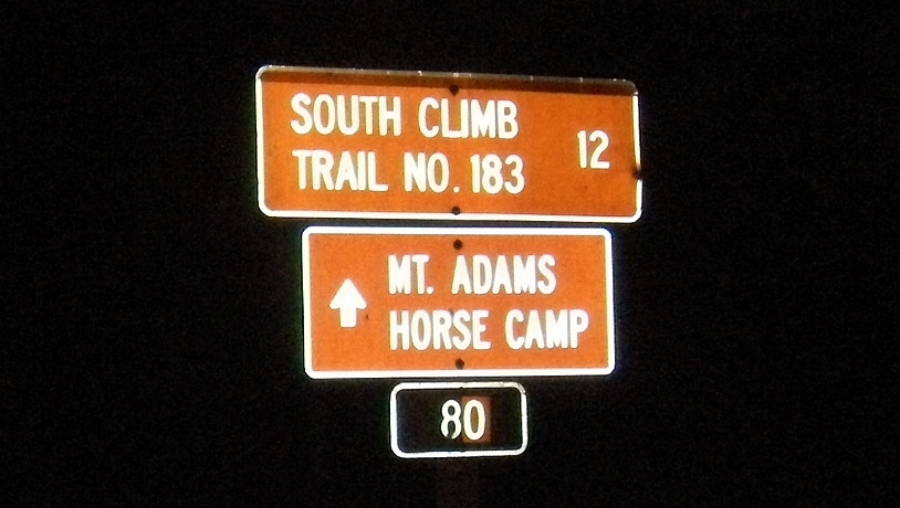
mountain, ranging from the "non-technical" South Climb, to highly
technical routes that require advance skill and special equipment. Most hikers take South Climb Trail #183 to the summit. Because of the high elevation, all
climbs have a measure of difficultly (altitude sickness) and danger. Weather on Mt. Adams can change unexpectedly and sudden
snowstorms can occur above 6,000’ in any season. Your safety relies on your
preparation and good judgment for the unexpected. Besides carrying the essentials and extra water/food/clothes, ice axes and crampons are recommended for South Climb. I'd also add trekking poles which I find
always useful.
The view of Mt. Adams from Mt. Rainier has always impressed me, and this time
the mountain view from Trout Lake was just stunning. There are several climbing routes on the
mountain, ranging from the "non-technical" South Climb, to highly
technical routes that require advance skill and special equipment. Most hikers take South Climb Trail #183 to the summit. Because of the high elevation, all
climbs have a measure of difficultly (altitude sickness) and danger. Weather on Mt. Adams can change unexpectedly and sudden
snowstorms can occur above 6,000’ in any season. Your safety relies on your
preparation and good judgment for the unexpected. Besides carrying the essentials and extra water/food/clothes, ice axes and crampons are recommended for South Climb. I'd also add trekking poles which I find
always useful.
I made a day hike all the way to
summit and back, which was physically
demanding. I arrived at the trailhead around 2:30 am, took a few hour nap in the car and began my adventure trek around 6:30am. 11.5 hour straight RT hike was quite challenging with 6,700’ elevation gain in 6 miles. Most climbers begin their ascent one day and spend the night at Lunch Counter about 9,000’ in order to adjust to the altitude. Lunch Counter is the relatively flat area and surrounded by rocks above Crescent Glacier. It is the most commonly used base camp of South Climb to the summit. You can also choose a more sheltered area below Crescent Glacier in the Morrison Creek drainage.
 Cascades Volcano Pass is required
for climbing above 7,000’ in Mt. Adams Wilderness between June 1 and September
30. Also, you need to sign in Climbing Register for your safety so that the forest service can use the information to check on overdue climbers. It takes about 5 - 6 hours driving from Seattle to
the South Climb trailhead. Plan details
and timing before you travel to Mt. Adams.
You need to stop by at the Mt. Adams ranger station in Trout Lake for
Cascades Volcano Pass and Climbing Register.
Cascades Volcano Pass is required
for climbing above 7,000’ in Mt. Adams Wilderness between June 1 and September
30. Also, you need to sign in Climbing Register for your safety so that the forest service can use the information to check on overdue climbers. It takes about 5 - 6 hours driving from Seattle to
the South Climb trailhead. Plan details
and timing before you travel to Mt. Adams.
You need to stop by at the Mt. Adams ranger station in Trout Lake for
Cascades Volcano Pass and Climbing Register.
demanding. I arrived at the trailhead around 2:30 am, took a few hour nap in the car and began my adventure trek around 6:30am. 11.5 hour straight RT hike was quite challenging with 6,700’ elevation gain in 6 miles. Most climbers begin their ascent one day and spend the night at Lunch Counter about 9,000’ in order to adjust to the altitude. Lunch Counter is the relatively flat area and surrounded by rocks above Crescent Glacier. It is the most commonly used base camp of South Climb to the summit. You can also choose a more sheltered area below Crescent Glacier in the Morrison Creek drainage.
 Cascades Volcano Pass is required
for climbing above 7,000’ in Mt. Adams Wilderness between June 1 and September
30. Also, you need to sign in Climbing Register for your safety so that the forest service can use the information to check on overdue climbers. It takes about 5 - 6 hours driving from Seattle to
the South Climb trailhead. Plan details
and timing before you travel to Mt. Adams.
You need to stop by at the Mt. Adams ranger station in Trout Lake for
Cascades Volcano Pass and Climbing Register.
Cascades Volcano Pass is required
for climbing above 7,000’ in Mt. Adams Wilderness between June 1 and September
30. Also, you need to sign in Climbing Register for your safety so that the forest service can use the information to check on overdue climbers. It takes about 5 - 6 hours driving from Seattle to
the South Climb trailhead. Plan details
and timing before you travel to Mt. Adams.
You need to stop by at the Mt. Adams ranger station in Trout Lake for
Cascades Volcano Pass and Climbing Register. 
Distance: 5.7 miles (South Spur)
Elevation Gain: 6,650'
Summit Elevation: 12,281'

2455 Hwy 141
Trout Lake, WA 98650
Phone: (509) 395 3400
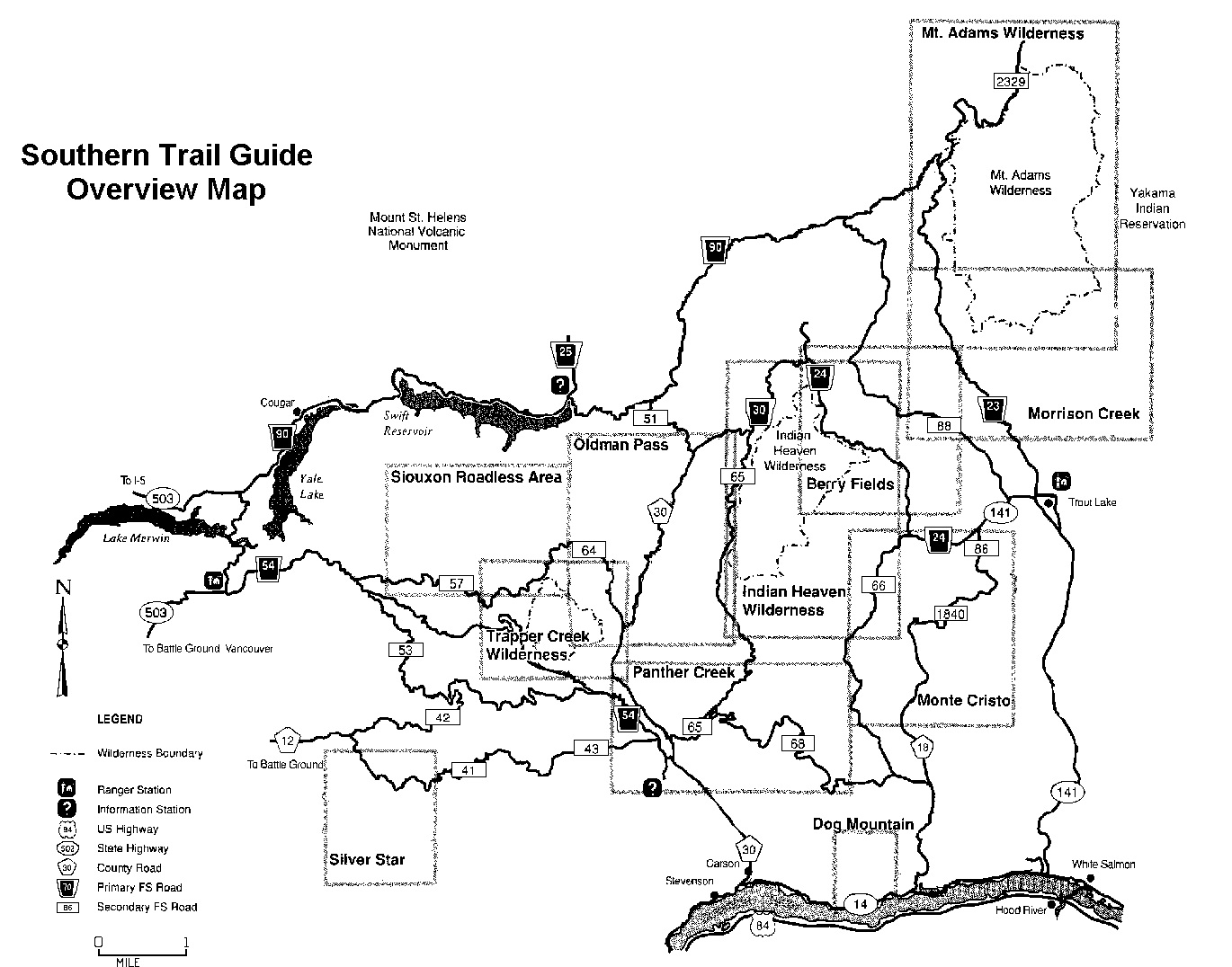
Directions to the Ranger Station: At Bingen, WA., take Hwy 141 north 25 miles to Trout Lake, WA. Continue on Hwy 141 through Trout Lake, one mile , and you will see the sign for the Mt. Adams R.D.
Additional Resources:
- More information about the Trout Lake area
- General Area Map Mount Adams Vicinity
- Mount Adams Climbing Conditions Report
- Recreation Conditions Report
- Northwest Weather and Avalanche Center
- Washington State Snow Survey


Cold Springs Campground at 5,600'. Some climbers choose here for their base camp and aim to summit in one day instead of camping overnight at Lunch Counter.


The first 1.5 miles or so is a gradual ascent and you trek through the forest. Enjoy wildflowers!


Trail sign en route. Follow the trail to South Climb #183 to the summit. Once you clear the forest line, the area opens up and the route may be still snow covered, and icy.

Snowfield begins after the forest line. Important to remember the way you came from the forest. Some hikers sometimes get lost at the forest line when they descend back into it by keep going to a wrong direction. Make sure to get back into the right direction to return the parking lot. Mt. Hood (12,249') is over skyline.
 Mt. Adams looms over Suksdorf Ridge at 8,000'. Lines of climbers and glissading are visible on the south face of Mt. Adams.


Surprise, surprise!?.....near 9,000', I was greeted by a local resident (marmot). Wildflowers blossoming.

Some campers choose to camp at lower elevation than Lunch Counter (9,200').
Mt. Hood towers alone on horizon.

View of Mt. Adams on the way to Lunch Counter.
The false summit - Piker's Peak (11,500').

Approaching Lunch Counter around 9,200'. This is the base camp for most hikers to camp overnight and adjust the altitude.


View of Mt. St. Helens (8,365') from Lunch Counter.

Time for crampons and ice axe around 9,500'. The route climbs up really steep soon after the snowfield above Lunch Counter. Be ready for this "butt Kicker". No rush, step at a time, pace yourself.....you don't want to run out of gas, nor get altitude sickness. Stay hydrated and have some snack as you rest.

Closeup view of the south face and Piker's Peak. Climbers ascending, descending, and glissading.


After ascending the steep grade 2,000', you'd wish this is the summit....but it is NOT. You just reached the false summit - Piker's Peak at 11,500'. You have another 700' to climb to the summit.


Finally, the summit!
12,281'


View south of the summit - Mt. Hood (12,249') in front and Mt. Jefferson (10,497') in back.

View west of the summit - Mt. St. Helens (8,365').

View north of the summit - Mt. Rainier (14,410').

Back to Trailhead around 6pm. 11.5 hr RT hike was pretty rough and strenuous. But, it was worth it for sure. Mt. Adams.....it is certainly a great hike and a beautiful place on earth!
Panoramic summit view of Mt. Adams (30 sec.)
After climbing a great hill, one only finds that there are many more hills to climb. See the link below for more info.
ReplyDelete#climbs
www.ufgop.org