Tuesday, February 21, 2017

Golden Gate Bridge to Slacker Ridge - Marin Headlands, CA


December 18, 2016


You want a spectacular view of San Francisco and Golden Gate Bridge just for yourself?  Then, ditch the crowd of tourists at the Vista Point and do this hike! It's a fantastic hike from Golden Gate Bridge to Slacker Ridge which is part of Marin Headlands. I like doing this hike whenever I want to see a breathtaking view of SF and GGB just for myself!

Slacker Ridge is a great local hike for a good and quick workout with spectacular 360 views of SF city and the bay along with Pacific Ocean, Rodeo Valley, Mt. Tam, East Bay, Mt Diablo and beyond! Awesome hike....two thumbs up! 

It's a short hike (1.5 mile one way) gaining a moderate elevation up to 930 ft summit of Slacker Ridge, hiking up from the hillside of the north side of Golden Gate Bridge. You can combine this hike with other trails which are interconnected such as Rodeo Valley/beach, Tennessee Valley, Muir Woods, Mt. Tam, Marin Headlands, Kirby Cove, Battery Spencer, or trek across Golden Gate Bridge to Crissy Field. See the map.

You can also make a longer journey towards Lands End hiking from the south end of GGB, which offers a series of stunning views throughout this old historical trail. Cypress forest and wildflowers, views of shipwrecks, access to the Legion of Honor and finally reaching the ruins of Sutro baths at Lands End.

Trailhead:
Trailhead is located along Conzelman Rd about 1/4 mile up the road from North Tower Golden Gate Parking (Northwest Commuter Parking Lot).  Walk back the road uphill from the parking lot. There is a trail sign by the road which says SCA Trail. Follow SCA trail about a mile and go left at the intersection to follow Slacker Ridge trail.


Mt. Tamalpais Trojan Point - Mill Valley, CA


November 18, 2016


Hiked Matt Davis Trail - Coastal Trail from Trojan Point. It's my favorite trail in Mt. Tam for spectacular ocean views and SF Bay Area. Mt. Tam is one of the most popular local hikes in Marin, perhaps next to Tennessee Valley. It offers diversified hikes with various terrains through forests and open space. Ocean views along the trails are amazing. There are many trails interconnecting in Mt. Tam and its vicinity including Muir Woods, Muir Beach, Stinson Beach and part of California Coastal trail system which spans the entire CA coast and Oregon.  You can explore Mt. Tam for a quick workout, day hike or multi-day hike. Options are so many to choose from. Designated camp sites available for overnight.

For more info about Mt. Tam hiking, go to Friends of Mt. Tam. 


http://www.friendsofmttam.org/wp-content/uploads/map-Mt-Tam-trailheads-1000.png

Tuesday, February 14, 2017

Tomales Point - Point Reyes National Seashore, CA


January 27, 2016

Distance:  9.5 miles RT
Elevation Gain: 1,300 ft
Difficulty: Easy to moderate


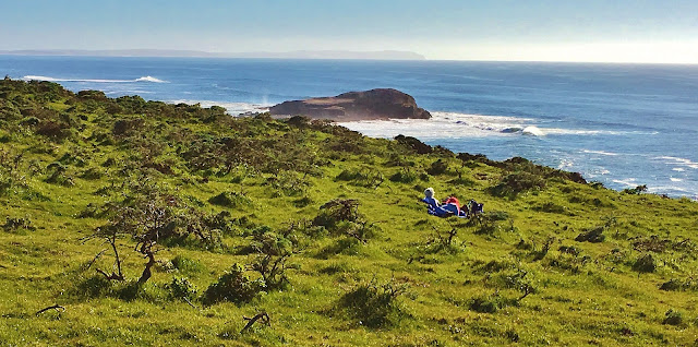
Point Reyes National Seashore offers a variety of beautiful hikes and Tomales Point is one of the best among them.  The trail travels through the Tule Elk Reserve and chances are you can sight several herds of tule elk along the journey, also with breathtaking views of the Pacific Ocean. Luck be with you, and you could also spot whales traveling off the seashore. 


Tomales Point trailhead is located at the Historic Pierce Point Ranch. The trail is well maintained and easy to follow. It gets sandy part of the way for the last mile or so to the end of the Point....good workout! Stay on trail and do NOT disturb sensitive natural habitats. Enjoy fantastic panoramic vistas all along and at the north end of the peninsula - Tomales Bluff, Pacific Ocean, Dillon Beach and Bodega Bay.  Be careful not to stand too close to the edge of the cliff as the trail is washed out at the end and the ground is cracked and fragile.

I recommend this hike when weather is nice and calm as Point Reyes is quite often windy and foggy. Fog can limit visibility and wind would make this hike more challenging. There is no shade along the trail, so make sure to bring enough water and stay hydrated.  Extra layers are a good idea as this is a coastal trail and weather can change quickly.  Make sure to leave no trace in this beautiful natural wonderland.  

Restroom is available at McClures Beach trailhead down the road from Pierce Point Ranch.  Follow the sign.

Bear Valley Visitor Center
Point Reyes National Seashore's primary Visitor Center provides useful info of the park's roads, trails, and human and natural history. It's wroth stopping by on the way to Point Reyes. Rangers can answer your questions and provide useful info.


Tuesday, February 7, 2017

Tioga Pass, Tuolumne Meadows and Lower Cathedral Lake - Yosemite National Park, CA


"This I may say is the first time I have been to church in California." 
 (John Muir after making the first recorded ascent of Cathedral Peak in 1896.)


October 22, 2016


Distance:  7 miles round trip to Lower Cathedral Lake 
Trailhead Elevation:  8,500 ft  
Lower Cathedral Lake Elevation:  9,290 ft
How to Get there: Traihead is located at 1/2 mile west of the Tuolumne Meadows Visitor Center. Park your car along the road and make sure not to block traffic. Shuttle Stop #7.  Start hike at Cathedral Lakes trailhead, 

Late October, gorgeous fall colors are seen along Tioga Pass Road as you drive from HWY 395 to Yosemite National Park's high country. Snow capped eastern High Sierra's craggy peaks are so dramatic and breathtaking.  

The hike starts near Tuolumne Meadows along Tioga Road. The trail to Cathedral Lake is part of the John Muir Trail.  This is a very popular hike, so there will be other hikers on the trail.  But, no worries....crowds are much less compared to Yosemite Valley's zoo like condition

Lower Cathedral Lake offers quite impressive landscape of Yosemite's granite slabs/boulders and High Sierra's peaks with alpine lakes. Cathedral Peak, Echo and Tresidder Peaks loom along Lower Cathedral Lake. Enjoy spectacular landscape and views of high peaks and the alpine lake. It's like you are in a paradise. You can explore trekking along the meadows and the lake. There are plenty of perfect spots for your lunch or napping on the granite slab around the lake.

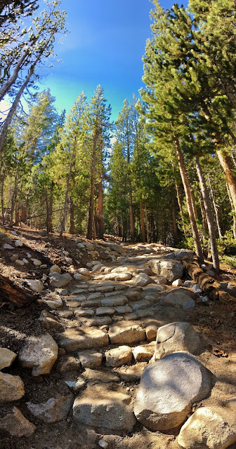
The hike climbs steadily from the beginning, but it's mostly gradual grade with some steep sections. Overall, it's easy to moderate hike, except high altitude/8,500 - 9,290 ft. You can also hike up to Upper Cathedral Lake adding extra 1/2 mile with 300 ft gain if you wish.