Showing posts with label hiking. Show all posts

Saturday, January 29, 2022

Hiking Mt. Karamatsu 唐松岳


Hiked on 9/15/2021


Mt. Karamatsu, known as Karamatsu-dake(唐松岳) is located in Hakuba, Nagano prefecture, where the 1998 Winter Olympic Games took place.


A couple of ski lifts take you up to trailhead/Happoike Sanso at 1850m. For RT it takes about 7hrs with 850 meter elevation gain and loss. The hike offers a pristine alpine lake, seasonal wildflowers, fall folisge and wildlife such as Ptarmigan, known as Raichō(雷鳥) and Japanese Macaque monkey Nihonzaru(ニホンザル).


Mt. Karamatsu is a great day hike to explore and get a taste of the Northern Alps of Japan with breathtaking landscape, mountain peaks, pristine alpine lakes and beautiful nature in all directions. 👍👍


Japanese macaque monkey(ニホンザル):

I wasn’t really expecting monkeys with this hike, but came across quite a few of them en route as they were coming and going across the trail here and there. It was like playing “hide and seek” along the trail with them! 😅🐵🐒


Stats(approx.):

Distance: 10km/6.2miles

Gain: 850m/2,789'

Summit: 2,696m/8,845’

Time: 7hr RT


Camera: iPhone 8


Video by Lifeisamt


Sunday, March 21, 2021

Mt. Adatara Fall Foliage Hike - 安達太良山 紅葉ハイク


October 20, 2020 

Spectacular display of fall foliage is on parade in Mt. Adatara, Fukushima, Japan. Gorgeous fall colors are breathtaking and can be seen endlessly all along the trail and through the mountains as you go. This is one of the most beautiful fall hikes I’ve gone for.🍁🍁🍁 Totally jaw dropping and eye popping! 😲🤩 The massive volcanic crater near the top is quite a sight and otherworldly.🌋 

The hike offers spectacular vistas, colors and landscape. In addition, soaking in the hot springs right by trailhead wraps up the hike perfect!♨️👍

Trail is well maintained and hiking boots are recommended as the route gets partially rocky and muddy. 

Hiked on 10/20/2020 
Summit: 1,700m(5,577ft) 
Gain: 750m(2,460ft) 
Distance: *10km(6.2 miles) loop including 2km/ropeway to descend 

*I took 6km(3.7 miles) route to summit Mt. Adatara ascending from Okudake trailhead via Kurogane Hut. However, most people take 4km route to Mt. Adatara using ropeway from trailhead to Yakushidake and trek to summit. 

Info about Mt. Adatara: https://www.city.nihonmatsu.lg.jp/page/page002703.html


Video by Lifeisamt


Hiking Chausu-dake (Nasu-dake) - 茶臼岳(那須岳)


August 20, 2020

I went on a half day/sunset hike scaling Mt. Chausu (Chausu-dake/1,915m) which is an active volcano. It’s one of the five volcanic mountains forming Nasu Five Peaks (Nasu-go-take). Nasu-dake is located in the north of Nikkō National Park, Japan. It’s also listed as one of the best 100 mountains in Japan.

What a great hike! This is a good workout hike with spectacular views, dramatic landscapes, volcanic steam rising, and mystical energy surrounding. It’s really cool. Two thumps up!!👍👍 

The trail is in good shape, well marked and relatively short (100 minutes to summit according to trail map). It gets rocky as you ascend, so hiking boots are recommended. Stay hydrated along the way if you hike Nasu-dake in summer as the trail is mostly exposed to the sun with no shade. ☀️😅 Happy hiking! 👍😎 

Hike Date:          8/20/2020 
Distance:           10-12km RT(?) 
Elevation Gain:   500m (approx.) 
Summit:            1,915m

Japan National Park: Nasu-dake


Video by Lifeisamt


Wednesday, February 20, 2019

Yosemite Firefall 2016


Natural Firefall in Yosemite Valley on February 24, 2016. About two weeks in late February, when the right conditions come together, the sunset light hits El Capitan’s Horsetail Fall at perfect angle. As a result, the waterfall is illuminated glowing like a fire-fall.

2016 February presented a perfect condition for the firefall, with enough snow and water for Horsetail fall, thanks to El Nino, and the weather was favorable for the firefall to occur.

2019 February may bring another great opportunity for Firefall due to the significant amount of the rainfall and snow received this winter.


Video by Lifeisamt

Thursday, December 6, 2018

Mt. Tsukuba Nantaisan via Miyukigahara Trail & Fall Colors 筑波山男体山 御幸ヶ原コースと秋の紅葉 12/2/2018


Hiking up Mt. Tsukuba Nantaisan via Miyukigahara Trail 筑波山男体山 御幸ヶ原コース. Fall colors are still beautiful, but fading quickly now....colors were still nice around Tsukubasan Shrine (筑波山神社) and the cable car station.

Miyukigahara Trail 御幸ヶ原コース
This trail is a great workout and challenging/strenuous, so be prepared. Not ideal for beginners.

Summit Elevation: 871m
Distance: 2.5km
Elevation Gain: 610m
Difficulty: Difficult/Strenuous

Mt. Tsukuba
Mt. Tsukuba(Tsukubasan筑波山), one of 100 famous mountains in Japan, is located in Ibaraki Prefecture, within an hour from Tokyo by train (Tsukuba Express). For centuries Mt. Tsukuba has been worshipped as “sacred mountain” with the entire mountain seen as a body of deity. That said, there are shrines and sacred meanings attached to various locations in the mountain. There’s also a saying about Mt. Tsukuba and Mt. Fuji, “nishi no Fuji, higashi no Tsukuba,” that is, Mt. Fuji in the west and Mt. Tsukuba in the east.

The journey
People usually start from Tsukubasan Shrine (Tsukubasan Jinja 筑波山神社) or Tsutsujigaoka (つつじヶ丘), but my hike began from Numata, a small town at the foot of the mountain, which added extra 2.5km to the journey. It was worth for the extra effort, however, sightseeing through a quaint mountain community and businesses such as local foods and souvenirs. Mt. Tsukuba is a rocky mountain with dense forest and twin peaks, Nyotaisan (“female body”)/877m and Nantaisan (“male body”)/871m. There are several hiking trails to scale the mountain, and trailheads are located near Tsukubasan Shrine (Tsukubasan Jinja 筑波山神社) on the mountainside and Tsutsujigaoka (つつじヶ丘) where the ropeway station is, depending on which hiking course you want to take.

Miyukigahara Trail 御幸ヶ原コース
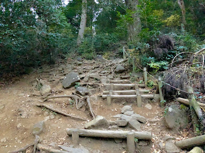
This trail offers a great workout hike ascending vertically straight up along steep rocky terrains. The route is the most rugged and steepest in Mt. Tsukuba, but shortest approach to the summit. At the top, take in panoramic vistas from Nantaisan....however, Nyotaisan offers better views, I'd say. Miyukigaraha trail surely kicks your butt and burns your leg muscles.  If you like a challenging hike, this hike will not disappoint you!

Bring layers as temperature could change significantly at the top. Trekking poles may be useful.

For my Nyotaisan hike女体山ハイク report:
http://johnshiking.blogspot.com/2018/12/mt-tsukuba-nyotaisan-via-shirakumobashi.html


Video by Lifeisamt