San Jacinto Peak , CA – 10,833’
4-30-2010
San Jacinto Peak Trail
11 miles RT
Elevation gain – 2,300'

San Jacinto Muntains and its peak on the left and San Gorgonio Mountain on the right.
San Jacinto Peak 10,833’
is the highest peak of the San Jacinto Mountains, and one of the top
three highest peaks in Southern
California – two others are San Gorgonio (11,500’) and Mt. San Antonio (10,064’).
The trail is part of Mount San Jacinto State Wilderness, and the
hike begins with Palm Springs Aerial Tramway which takes you a
mile straight up into the San Jacinto wilderness from 2,643’ Valley
Station (lower tramway terminal) to Mountain Station (upper terminal ) at 8,516’.
Enjoy the ride as its floor rotates so that you can get the breathtaking 360 view
of the San Jacinto wilderness. The hike starts from Mountain Station. Follow
the walkway to the Long Valley Ranger Station where you need to get a
day use wilderness permit. At the end of April, the snow was
still deep in this hike, so I snowshoed up to the summit. First, obtain update info on snow and climbing
condition at the ranger station before you head out into the wilderness. There is no visible trail when it’s snow
covered. That means your map and compass are the best navigation tools that you can rely
on. In fact, I almost got lost on the way to descend because the
snow covered route and trees all over in all directions were a bit confusing with
no sight of mountain peaks around to sense where you are. Compass bearing is the key. Start out the hike with the ranger station,
and travel west along the treeline following the signs to Round Valley. The
path also parallels Long Valley Creek (you can hear the running stream), which I followed part of the way. At Round Valley, you find
a campground and a backcountry ranger station. From Round Valley follow the sign
for Wellman Divide and continue toward the summit. I snowshoed straight up on the face of the saddle
instead of switchbacks, which was quite a butt kicker! Capture the grand vistas from the summit - John
Muir said about the summit view “the most sublime spectacle to be found
anywhere on this earth!”
How to get there: From Interstate 10, take Palm Springs exit on Hwy 111. Drive nine miles to Tramway Road and turn right. Follow the road 3.5 miles to Valley Station. Take the tramway to Mountain Station and go to the ranger station for wilderness permit. Contact the Palm Springs Aerial Tramway office for prices and schedules.

View of San Jacinto wilderness from Valley
Station (lower tramway terminal) at 2,643'.

Tramway going up to Mountain Station at 8,516’.

San Jacinto Peak Trail Map

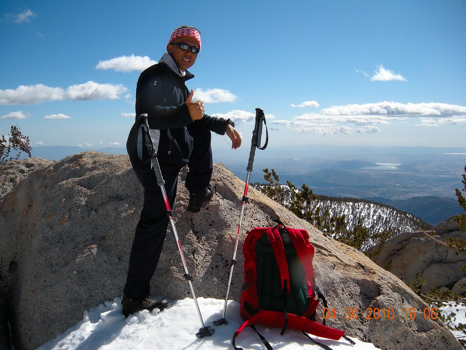
At San Jacinto Summit.

Panoramic view NE of San Jacinto - Mt. Baldy and San Gorgonio are seen prominent in skyline.
No comments:
Post a Comment