Showing posts with label volcano. Show all posts

Sunday, March 21, 2021

Mt. Adatara Fall Foliage Hike - 安達太良山 紅葉ハイク


October 20, 2020 

Spectacular display of fall foliage is on parade in Mt. Adatara, Fukushima, Japan. Gorgeous fall colors are breathtaking and can be seen endlessly all along the trail and through the mountains as you go. This is one of the most beautiful fall hikes I’ve gone for.🍁🍁🍁 Totally jaw dropping and eye popping! 😲🤩 The massive volcanic crater near the top is quite a sight and otherworldly.🌋 

The hike offers spectacular vistas, colors and landscape. In addition, soaking in the hot springs right by trailhead wraps up the hike perfect!♨️👍

Trail is well maintained and hiking boots are recommended as the route gets partially rocky and muddy. 

Hiked on 10/20/2020 
Summit: 1,700m(5,577ft) 
Gain: 750m(2,460ft) 
Distance: *10km(6.2 miles) loop including 2km/ropeway to descend 

*I took 6km(3.7 miles) route to summit Mt. Adatara ascending from Okudake trailhead via Kurogane Hut. However, most people take 4km route to Mt. Adatara using ropeway from trailhead to Yakushidake and trek to summit. 

Info about Mt. Adatara: https://www.city.nihonmatsu.lg.jp/page/page002703.html


Video by Lifeisamt


Hiking Chausu-dake (Nasu-dake) - 茶臼岳(那須岳)


August 20, 2020

I went on a half day/sunset hike scaling Mt. Chausu (Chausu-dake/1,915m) which is an active volcano. It’s one of the five volcanic mountains forming Nasu Five Peaks (Nasu-go-take). Nasu-dake is located in the north of Nikkō National Park, Japan. It’s also listed as one of the best 100 mountains in Japan.

What a great hike! This is a good workout hike with spectacular views, dramatic landscapes, volcanic steam rising, and mystical energy surrounding. It’s really cool. Two thumps up!!👍👍 

The trail is in good shape, well marked and relatively short (100 minutes to summit according to trail map). It gets rocky as you ascend, so hiking boots are recommended. Stay hydrated along the way if you hike Nasu-dake in summer as the trail is mostly exposed to the sun with no shade. ☀️😅 Happy hiking! 👍😎 

Hike Date:          8/20/2020 
Distance:           10-12km RT(?) 
Elevation Gain:   500m (approx.) 
Summit:            1,915m

Japan National Park: Nasu-dake


Video by Lifeisamt


Tuesday, November 19, 2019

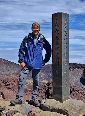
Climbing Mt. Fuji (3,776m/12,390ft) - 9/16/2019


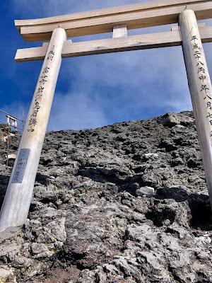
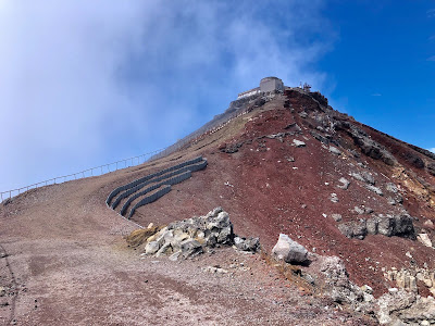
Mt. Fuji summit crator

The Journey

Climbing Mt. Fuji was one of my bucket lists this year, so I'm glad I could cross that out. I scaled Mt. Fuji via Fujinomiya Route on 9/16/2019. The official climbing season/2019 ended on September 10, and mountain huts/toilets en route were already closed and not available until 2020 season. Hence, I climbed at my own risk. Be well prepared for frequent weather/temp change (rain, mist, gust, rockfall, whiteout, clouds and intense sun) and altitude sickness during the climb as Mt. Fuji is a solitary mountain and the surrounding weather changes so quickly as it develops its own weather. 

Mt. Fuji is named UNESCO’s World Heritage Cultural site since 2013. Climb and experience Mt. Fuji in environmentally/ecologically conscious manner for generations to come. 

Distance/Fujinomiya Trail: 10km RT 
Elevation Gain: 1,376m (2,400/3,776) 
Summit: 3,776m (Kengamine Peak)

About Mt. Fuji  

Mt. Fuji (Fujisan) is the most iconic peak of Japan. It is Japan's highest (3,776m/12,390ft) and most famous mountain, inspiring Japanese art and literature for centuries. It is also revered as a sacred mountain and many climbers attempt to summit and see the sunrise. Mt. Fuji is an active stratovolcano and last erupted in 1707-1708.

The official climbing season is from early July to mid September. This is when the mountain is usually free of snow and the weather is relatively mild.

There are 4 officially designated trails for climbing Mt. Fuji, and each trail is divided into 10 stations with 5th station as trailhead. The 4 trails are Yoshida, Fujinomiya, Subashiri, and Gotemba trails. Depending on the trail, the terrain and condition of the climbing route vary with distance, incline, rockiness/sandiness, facing north/east/south.  

Yoshida Trail

Elevation: 2300m
Ascent: 6 hours
Descent: 3.5 hours
This is the most popular climbing route and the most accessible with many mountain huts along the way.

Fujinomiya Trail

Elevation: 2400m
Ascent: 5 hours
Descent: 2 hours and 45 minutes
This is the southern approach to summit. It is the shortest and steepest route. 

Subashiri Trail

Elevation: 2000m
Ascent: 5.5 hours
Descent: 3 hours
Subashiri Trail starts in the forest and meets Yoshida Trail near the 8th station.

Gotemba Trail

Elevation: 1400m
Ascent: 7.5 hours
Descent: 3 hours
This is the longest approach to summit per time and distance and the terrain is sandy.

For detailed infomation and guidelines of climbing Mt. Fuji, visit the official web site for Mt. Fuji Climbing.


Video by Lifeisamt

At Mt. Fuji summit: 3,776m (Kengamine Peak)


Monday, May 30, 2016

Boundary Trail - Mount St. Helens, WA


I decided to return to Mount St. Helens again since last week's Boundary trail (west) hike via Hummocks Trail which I really enjoyed. This time I wanted to hike the east side of Boundary Trail from Johnston Ridge Observatory. Also, this week happened to be the 36th anniversary since May 18, 1980 eruption.
After spending a short time visiting Johnston Ridge Observatory, I started out my hike from the trailhead right by the observatory building. The trail is paved part of the way to the vista point upon the hill and eventually splits into two directions....one (paved) loops down to the main parking lot and the other (dirt) continues along the ridge towards Boundary Trail (east) which interconnects to Truman Trail.


As you hike along the route, enjoy the breathtaking views of Mount St. Helens on one side and the rocky peaks and mountain valley on the other. The views are quite dramatic and show such a contrast....moon like terrains devastated by the eruption vs. rocky mountain peaks with deep green forest. Wildflowers are just beginning to bloom in colors of spring adding to the scenery.


There was a sign which said "Boundary Trail is closed at 1.5 miles/Devil's Elbow due to slides", but the slides area is restored and safe to pass Devil's Elbow although it is very exposed and sheer drop, so use caution when you traverse Devil's Elbow.


Take in the stunning views at the vista point of Devil's Elbow....Mount St. Helens directly facing to north, Pumice plain, Spirit Lake and Mt. Adams. From this point on, the trail slightly descends and soon meets with Truman Trail. There the options are either to continue Boundary trail towards Mount Margaret/St. Helens Lake or take Truman Trail towards Mount St. Helens pumice plain/Loowit Falls. I ended my journey right before Truman Trail and turned around. The trekking distance was about 2.5 miles one way from the observatory.


This is a great hike with fantastic views without much elevation gain. With wildflowers fully blooming soon (hopefully), the hike will be totally exquisite!


Wednesday, May 11, 2016

Hummocks Trail and Boundary West Trail - Mount St. Helens, WA


May 9, 2016


Hike of the week recommended by WTA. I decided to head out to hike Hummocks trail combined with Boundary West. The weather was perfect...sunny and not too warm as there was a light breeze.

This is a wonderful hike for all ages, particularly Hummocks Trail. It offers fantastic views of Mount St. Helens with educational and interesting information about the geology and history of Mount St. Helens since the volcanic eruption in 1980. It is amazing you can actually hike along the area where the landscape and ecology were devastated by the eruption and it's been reforming by nature's own will and cycle ever since. I learned so much of the area's landscape geology through the hike.

From the trailhead, I followed Hummocks Trail and at the trail junction I continued on to Boundary Trail heading east. The trail is in good shape and easy to trek with gentle ups and downs. After about a mile in, it begins to climb steeply in switchbacks....be ready to get your heart rate going!

As you keep gaining elevations, the views of the valley down below and Mount St. Helens get better and better. Seeing a remnant of the past all along the trail, you could only imagine the catastrophic force of the eruption which wiped out the area 36 years ago.

I stopped the hike before reaching Loowit Viewpoint because I was running out of time after 7pm. So, I enjoyed the spectacular views of Mount St. Helens and the valley down below on the way and turned around to head back to the trailhead. I returned to my car a little after 8pm. Interestingly, I saw a cougar crossing the highway soon after I drove out of the trailhead parking lot. It looked like a little over 2 ft long and had a dark brown fur.

Wildflowers are just starting to bloom....paintbrush, lupine, phlox, foxglove and so on. They will get into full swing very soon if weather cooperates. The road to Johnston Ridge Observatory is still closed at Coldwater Lake, but it is scheduled to open this weekend/May 14. I would like to go back to hike and explore again....perhaps, hike around the observatory and Spirit Lake area next time.